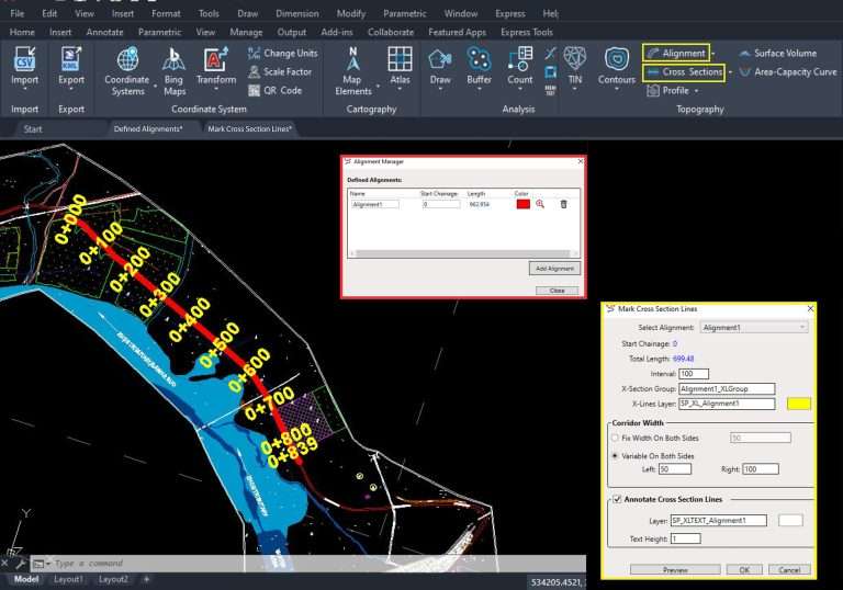
Export AutoCAD Drawing to KML
Exporting AutoCAD drawings to KML format enhances visualization in Google Earth. Converting drawing objects into KML files allows easy viewing and interaction within Google Earth.
Ensuring Accuracy: Conversion of Coordinates
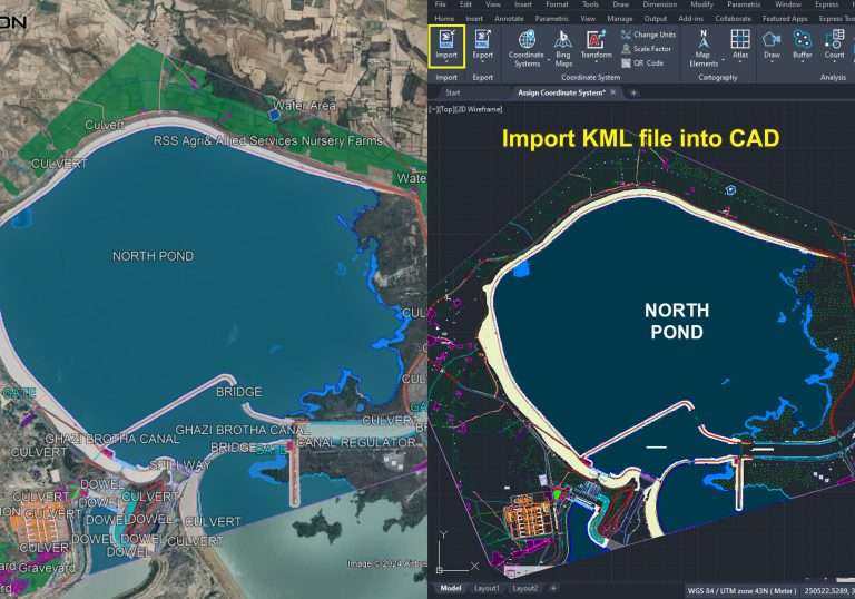
Exporting AutoCAD drawings to KML converts projected coordinates into geographic coordinates. This ensures precise positioning on the Earth’s surface, regardless of the original coordinate system.
Exploring Spatial Context: Integration with Google Earth
Integration with Google Earth overlays drawings onto satellite imagery and terrain models. This provides insights into the relationship between designs and the environment.
Maintaining Integrity: Preservation of Drawing Attributes
The export process preserves drawing attributes like colors and linetypes. This maintains visual consistency when viewing in Google Earth.
Facilitating Sharing and Collaboration
Exporting AutoCAD drawings to KML is a simple process. Users can share KML files with colleagues or stakeholders for effective collaboration on design projects.
In summary, exporting AutoCAD drawings to KML offers a convenient way to view and analyze designs in Google Earth. By converting coordinates and preserving attributes, this workflow enhances usability and accessibility for various applications.