Create Atlas Sheets for a Closed Polyline
Overview of Atlas Sheet Design Creating atlas sheets is a crucial step in urban planning and cartography projects,…
WHAT CAN SPCAD DO FOR YOU?
SPCAD is a powerful CAD tool designed to enhance your geospatial and design projects with a range of advanced features. Here’s what SPCAD can do for you:
Seamless Import/Export:
Import and export various file formats, including KML/KMZ, shapefiles, CSV, GPX, LAS, GeoJSON, and raster images with world files, facilitating smooth data integration and sharing.
Coordinate Systems Management:
Manage and transform coordinate systems in your drawings. Assign and convert between different coordinate systems to ensure precise alignment and accuracy.
Bing Maps Integration:
Integrate satellite imagery by selecting a coordinate system and boundary polygon to retrieve Bing Maps images, enhancing your spatial analysis and visualization.
Surface Analysis:
Perform detailed surface analysis with tools for TIN (Triangulated Irregular Network), contours, and profile drawing, providing critical insights into terrain and topography.
Efficient Map Making:
Create detailed maps with ease, adding symbols, North arrows, and scale bars. SPCAD simplifies the map-making process, ensuring professional and accurate results.
Advanced Cadaster Functions:
Manage land divisions and parcels effectively. Use tools for LOT division, quick parcel creation, and annotation, along with exporting data for comprehensive cadaster management.
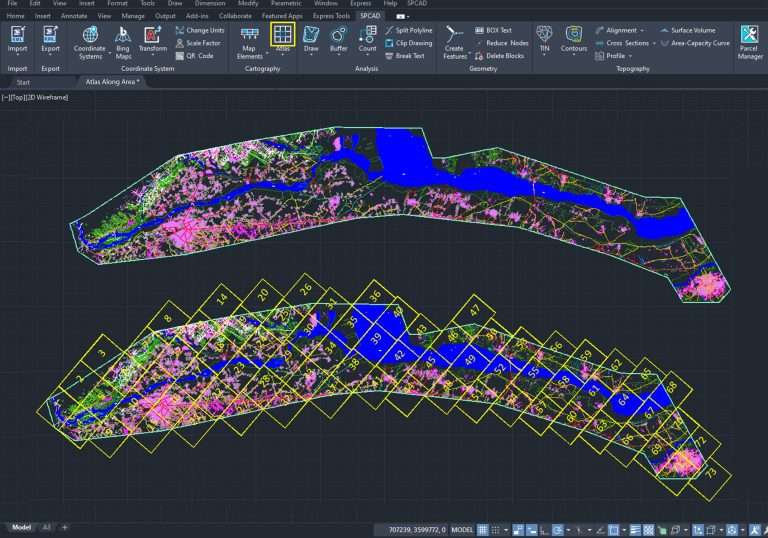
Atlas Creation:
Organize your designs into detailed atlases, improving data presentation and accessibility for better project management.
Area and Volume Analysis:
Generate Area Capacity Curves and analyze volumes with ease, streamlining workflows and enhancing project accuracy at various elevations.
Location-Based QR Codes:
Insert QR codes into your drawings that, when scanned, navigate to Google Maps for precise location access, improving on-site navigation and project coordination.
SPCAD’s robust features provide a comprehensive solution for managing geospatial data, enhancing workflow efficiency, and achieving accurate results in your CAD projects.
Overview of Atlas Sheet Design Creating atlas sheets is a crucial step in urban planning and cartography projects,…

How to Divide a Lot into Parcels Using SPCAD Lot Subdivision SPCAD tools allow urban planning CAD users…

Transform Your Geographic Data with Precision In SPCAD, converting Grid to Ground data is effortless. Our tool applies…

How to Display Coordinate System Information in CAD Using SPCAD The SPCAD Coordinate System Display tool allows CAD…

How to Merge Polygons in CAD for Accurate Design Results The SPCAD Polygon Merging tool makes it easy…

SPCAD Polygon Cutting – How to Cut Polygons in CAD for Accurate Designs In CAD workflows, the ability…
Enhance Your CAD Drawing with Orientation and Measurement References In CAD, adding a north arrow and scale bar…
SPCAD KML Export – Visualize CAD Drawings in Google Earth Exporting CAD drawings to KML format with SPCAD…

SPCAD Shapefile Export – Simplify Geospatial Data Conversion Exporting CAD drawings to ESRI Shapefiles is effortless with SPCAD….

Enhanced Roadway Design with SPCAD SPCAD provides a comprehensive solution for roadway design with SPCAD, enabling engineers and…