
SPCAD CAD Add-On – 150+ Tools for Mapping & CAD Design
Download 14-DAY Free Trial Today.
Download NowSPCAD Products
The SPCAD CAD Add-On empowers CAD and GIS professionals to streamline mapping workflows, generate TIN surfaces, create contours, manage cadastral data, and integrate QR codes directly into CAD drawings.
SPCAD Products


Who Uses SPCAD?
Discover the professionals and industries that rely on SPCAD to make their CAD and mapping work easier.
Discover Our Audience →What can SPCAD do for you?
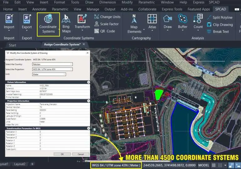
Assign a Projected Coordinate System to the CAD Drawing
In SPCAD numerous tools require assigning a related

Generate a QR Code for Point Locations
QR codes have emerged as a modern and secure method for sharing important information.

Import KML Files into CAD Drawing
KML files serve as a standard format in the geospatial community for sharing and visualizing location information.

Create TIN Surfaces from Point Objects
SPCAD emerges as a game-changer, simplifying the creation of TINs from point objects, thereby facilitating

Generate Contours from a TIN Surface
Introducing our latest CAD plugin feature: the Generate Contour Tool! This dynamic addition to our suite of
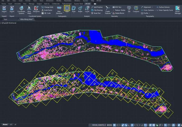
Create Atlas Sheets For A Closed Polyline
Select the viewport extent, layout, and sheet color. The user can change the number of

Import CSV Files To The CAD Drawing
Our plugin simplifies CSV file importation into CAD drawings, enabling CAD users
Cadastral Mapping using SPCAD
Cadastral mapping forms the backbone of every planned city. Accurate subdivision of land into lots

Define Alignment And Mark Chainage Along A Polyline
Alignment and mark chainage along are essential

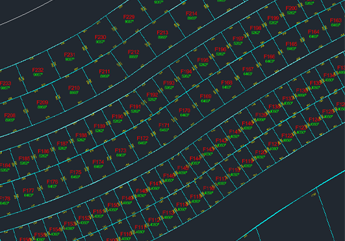
Divide A Lot Into Parcels
Urban planning CAD users are tasked with subdividing large lots into smaller parcels, adding annotations such
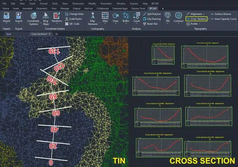
Cut a cross-section from a TIN Surface
SPCAD enables users to personalize titles, adjust vertical exaggeration and data intervals, and seamlessly tabulate

Import ESRI Shapefiles To CAD Drawing
The ESRI shapefile is a widely used data format, and integrating shapefile data into CAD
Work Smarter With SPCAD
Boost productivity and creativity with SPCAD. Download powerful tools and explore flexible pricing designed to fit your needs.