SPCAD FOR ProgeCAD
A high-performance engineering and GIS add-on packed with over 180+ specialized tools. It bridges the gap between CAD and GIS, simplifying complex drafting, topographic mapping, and spatial analysis tasks within a single, intuitive interface.
Functional Modules

01. DATA EXCHANGE (IMPORT/EXPORT)
Ensure seamless CAD–GIS interoperability with bi-directional data exchange. Import and export KML, SHP, GeoJSON, GML, XYZ, GPX, LAS, and CSV with full coordinate integrity. Convert CAD entities into GIS-ready attributes with block and table extraction.

02. COORDINATE SYSTEMS & GEO-TOOLS
With 4500+ global coordinate systems. Perform CAD transformations, raster georeferencing, and unit conversions. Import OSM data, download map tiles, and use tools for mosaicing, clipping, geotagging, geo-distance calculation, and QR-based location access.

03. CARTOGRAPHY & ATLAS PRODUCTION
Create professional maps with automated atlas sheets. Add dynamic elements like north arrows, scale bars, and legends. Generate labels, grids, and high-quality PDF outputs with precise cartographic control.

04. SPATIAL ANALYSIS
Perform buffering, offsets, clipping, merging, and Voronoi generation. Create and refine features using convex hull, shrinkwrap, and point-based tools. Analyze data with polyline editing, counting, and text processing.
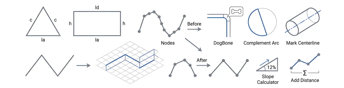
05. GEOMETRY & INQUIRY TOOLS
Create and edit geometry with tools for 2D–3D conversion, node optimization, and line tracing. Use advanced functions like vertex insertion, arc tools, best-fit polylines, and interpolation. Verify geometry with distance and slope analysis.
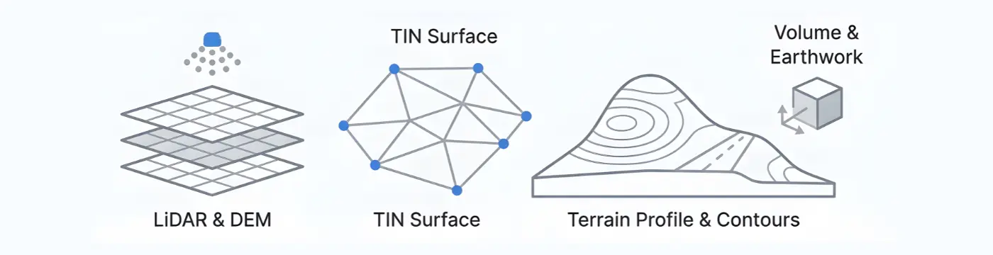
06. TOPOGRAPHY & TERRAIN MODELING
Model and analyze terrain with TIN surfaces, point groups, LiDAR, and DEM tools. Generate contours, grading designs, and volume calculations. Create profiles, cross sections, and alignments for complete site evaluation.

07. CADASTER (LAND DIVISION TOOLS)
Manage parcels with a dedicated Parcel Manager. Perform land division, quick subdivision, and advanced labeling. Export accurate cadastral data for efficient planning and documentation.

08. SPCAD UTILITIES & SYSTEM MANAGEMENT
Manage licenses, updates, and language settings from a central hub. Access resources and help tools for a stable, localized, and well-supported workflow.
Training & Tutorials
TECHNICAL SPECIFICATIONS
| ProgeCAD Support | 2025 to 2026 |
| License Model | Annual Subscription |
| Multi-Device Activation | A single license can be activated on up to five devices |
| Free 14-Day Trial | Fully functional trial available with flexible extensions |
GLOBAL LOCALIZATION
Available in 4 languages for international teams:


